Creating 3D Maps for Disaster Response in Japan
Summary:
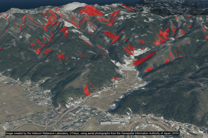
On January 1, 2024, a significant earthquake struck the Noto Peninsula in Ishikawa Prefecture, Japan, causing extensive damage, a tsunami, and ground uplift along the coast. In the immediate aftermath, Professor Hidenori Watanave of the University of Tokyo utilized satellite imagery and aerial photos to create digital maps for disaster response. Axelspace Corp., a startup, provided free satellite images that enabled quick assessment of the disaster zone. The Geospatial Information Authority of Japan (GSI) also provided aerial photographs, which were used to create detailed 3D maps.
These maps proved essential for understanding the extent of the damage, especially since physical access to many areas was hindered by landslides and ground uplift. The digital maps received widespread use, aiding not only the general public but also television stations and rescue operations. The maps highlighted specific damage, such as significant uplift at Nagahashi port, which rendered the area inaccessible by sea and land.
Professor Watanave continues to update these maps using new aerial photos, emphasizing their importance for ongoing monitoring and future disaster preparedness. The technology and methods developed are now being taught to journalists and students to ensure quick and efficient responses to future disasters. This initiative aims to democratize access to critical information and improve disaster response capabilities across society.


